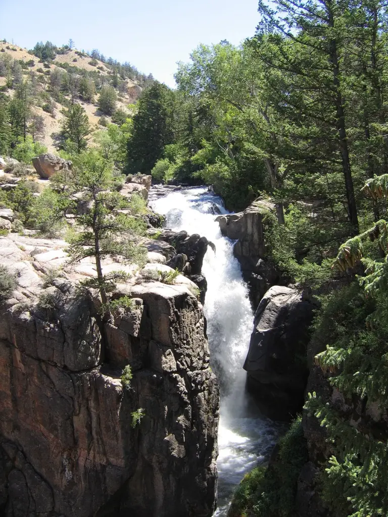
What makes Shell Falls special
Shell Falls is a waterfall in the Bighorn National Forest on Shell Creek, about halfway down Shell Canyon, and a few miles upstream from the town of Shell in northeast Wyoming. Wikipedia puts the height at 120 feet, and the fall tumbles over basement rock of granite: old, hard rock, laid bare by the canyon, with the creek cutting down through it.
The canyon is the setting. Shell Canyon is a deep cut through the Bighorns, and the falls sit about halfway down it, where Shell Creek drops over the granite. The rock is the story: granite basement rock, the foundation of the range, exposed where the creek has worn the canyon down. The fall is the creek meeting that rock and going over it.
Its neighbours are far away. Porcupine Falls is 23.8 miles away and Bucking Mule Falls 26.4 miles away, so Shell Falls is a drive-to stop on a canyon road rather than one fall in a tight cluster. That distance is part of the appeal: it is quieter than the famous falls, and the canyon around it is the point as much as the water.
Source: Wikipedia
Geology and background
The falls tumble over basement rock of granite, the old crystalline rock that forms the foundation of the Bighorn Mountains. Shell Creek has cut Shell Canyon down through younger rock to this granite base, and the fall is where the creek meets the hard basement rock and drops. The granite is why the fall holds its shape: it does not wear away quickly, so the drop stays steep and the canyon stays narrow.
Plan your visit
Getting there and parking
- GPS: 44.5864529, -107.6140453 — Get directions
Navigate by coordinates rather than by name. Map apps often send waterfall searches to the wrong parking lot or the far side of the stream. Download an offline map before you lose signal: this is canyon country, and signal is not guaranteed.
Best time and crowds
No stream gauge is linked to Shell Falls, so recent rain is your best guide. Expect the most water in spring and after heavy rain, when the snowmelt is running off the Bighorns. In a dry spell, especially late summer and early fall, the same fall can look half the size.
This is a quieter fall than the famous ones, and the canyon road keeps it that way. Even so, an early start is the best way to have the viewpoint to yourself.
Safety
Stay on marked trails and behind railings. Wet rock near the brink is the most common cause of serious injury. Never climb the cascade or stand at the top edge, even when the flow looks gentle. Plunge pools hide cold water, strong currents and submerged logs.
What to bring
- Shoes with real grip
- A rain shell for the spray
- Water and a snack
- An offline map or screenshot
- A dry bag for your phone
- A bag to pack out trash
Practical tips
- Screenshot the directions and these coordinates before you leave town: signal is thin in the canyon.
- Pair it with Porcupine Falls, 23.8 miles away, if you are driving the canyon road.
- Look for the granite at the base of the fall: it is the old basement rock of the Bighorns, laid bare by the creek.
- Tell someone where you are going if the road or the trail is long or remote.
Keep exploring
- More waterfalls in Wyoming
- Explore Wyoming waterfalls
- Porcupine Falls (23.8 mi away)
- Bucking Mule Falls (26.4 mi away)
- Explore the map
Leave a waterfall report