What makes Whinnimic Falls special
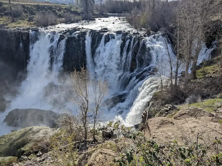
Whinnimic Falls is a waterfall in the headwaters of Lemah Creek in the Alpine Lakes Wilderness Area. It is set in a narrow valley below Lemah Mountain, and the fall plunges about 350 feet off a vertical cliff, onto a valley floor dotted with ponds and grassy meadows. The 350-foot figure is the description’s, from Wikipedia, not a verified measurement on this page.
The setting is the story. The stream heads in two tarns and the remains of a small glacier, so the water at Whinnimic Falls starts as mountain ice and snowmelt, gathers in high lakes, and then drops the full height of the cliff in one go. The valley floor below, with its ponds and meadows, is the soft landing after the hard drop.
It is one of two falls in the valley, the other being the smaller Upper Lemah Valley Falls. Iceberg Lake Falls is 1.7 miles away, Nellie Falls 3.6 miles away and Rampart Falls 4.8 miles away, so this is alpine country with several falls in reach of each other.
Source: Wikipedia
Geology and background
The fall begins in two tarns and the remains of a small glacier, high in the valley below Lemah Mountain. The creek drops from that ice-and-lake country over a vertical cliff, 350 feet down to a valley floor of ponds and grassy meadows. The shape of the valley — narrow, steep-sided, with a flat meadow floor — is the shape a glacier leaves behind, and the fall is the stream’s way down from the high lakes to the valley floor.
Plan your visit
Getting there and parking
- GPS: 47.4837, -121.282 — Get directions
Navigate by coordinates rather than by name. Map apps often send waterfall searches to the wrong parking lot or the far side of the stream. Download an offline map before you lose signal: this is wilderness country, and signal is not guaranteed.
Best time and crowds
No stream gauge is linked to Whinnimic Falls, so snowmelt is your best guide. Expect the most water in late spring and early summer, while the snow and the small glacier above are melting, and after heavy rain. In a dry spell, especially late summer and early fall, the same fall can look half the size.
This is a remote fall in the Alpine Lakes Wilderness, and the trailhead is unlikely to be crowded. Even so, an early start is the best way to have the viewpoint to yourself.
Safety
Stay on marked trails and behind railings. Wet, mossy rock near the brink is the most common cause of serious injury. Never climb the cascade or stand at the top edge, even when the flow looks gentle. Alpine water is colder than it looks, and the weather at this height changes fast: bring a layer even on a warm day.
What to bring
- Shoes with real grip
- A rain shell for the spray and the mountain weather
- Water and a snack
- An offline map or screenshot
- A dry bag for your phone
- A bag to pack out trash
Practical tips
- Go in late spring or early summer, while the snowmelt above is running.
- Pair it with Iceberg Lake Falls, 1.7 miles away.
- Screenshot the directions and these coordinates before you leave town: signal is thin in the wilderness.
- Tell someone where you are going if the trail is long or remote.
Keep exploring
- More waterfalls in Washington
- Explore Washington waterfalls
- Iceberg Lake Falls (1.7 mi away)
- Nellie Falls (3.6 mi away)
- Rampart Falls (4.8 mi away)
- Explore the map
Leave a waterfall report